 vesseltracker.com
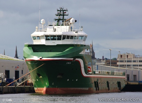
Vessel Enea IMO: 9465136, MMSI: 235079451 Offshore Tug Supply Ship
UTC, 57.68572, -2.36651, course: 289, speed: 0.5
UTC, 57.68572, -2.36645, course: 290, speed: 0.2
2026-01-31 15:47:51 UTC, 57.68574, -2.36642, course: 290, speed: 0.3
Live AIS position:
UTC. Near Gardenstown),
updated 2026-01-31 15:47:51 UTC.
Find the position of the vessel Enea on the map. The latter are known coordinates and path.
marine traffic ship tracker show on live map
The current position of vessel Enea is 57.68574 lat / -2.36642 lng. Updated: 2026-01-31 15:47:51 UTCCurrently sailing under the flag of United Kingdom
Enea built in 2010 year
Deadweight:
4993 tDetails:
Last coordinates of the vessel:
UTC, 57.68572, -2.36648, course: 291, speed: 0.3UTC, 57.68572, -2.36651, course: 289, speed: 0.5
UTC, 57.68572, -2.36645, course: 290, speed: 0.2
2026-01-31 15:47:51 UTC, 57.68574, -2.36642, course: 290, speed: 0.3