 vesseltracker.com
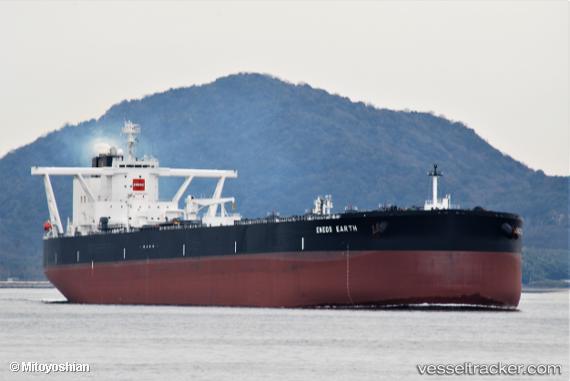
Vessel Eneos Earth IMO: 9814131, MMSI: 374542000 Crude Oil Tanker
UTC, 17.87658, 120.16182, course: 18, speed: 16.2
UTC, 18.27607, 120.30597, course: 19, speed: 16.1
2026-01-31 16:23:10 UTC, 18.91047, 120.68509, course: 33, speed: 15.3
Live AIS position:
UTC. 23 nm N of Bangui),
updated 2026-01-31 16:23:10 UTC.
Find the position of the vessel Eneos Earth on the map. The latter are known coordinates and path.
marine traffic ship tracker show on live map
The current position of vessel Eneos Earth is 18.91047 lat / 120.68509 lng. Updated: 2026-01-31 16:23:10 UTCCurrently sailing under the flag of Panama
Details:
Last coordinates of the vessel:
UTC, 17.31092, 119.95871, course: 21, speed: 16.3UTC, 17.87658, 120.16182, course: 18, speed: 16.2
UTC, 18.27607, 120.30597, course: 19, speed: 16.1
2026-01-31 16:23:10 UTC, 18.91047, 120.68509, course: 33, speed: 15.3