 vesseltracker.com
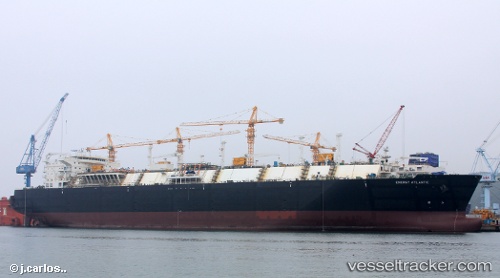
Vessel Energy Atlantic IMO: 9649328, MMSI: 256647000 Lng Tanker
UTC, 24.61116, 56.69435, course: 291, speed: 0.1
UTC, 24.61008, 56.69291, course: 334, speed: 0.2
2026-01-31 08:14:31 UTC, 24.60996, 56.69074, course: 24, speed: 0.2
Live AIS position:
UTC. 14 nm SE of Shinas),
updated 2026-01-31 08:14:31 UTC.
Find the position of the vessel Energy Atlantic on the map. The latter are known coordinates and path.
marine traffic ship tracker show on live map
The current position of vessel Energy Atlantic is 24.60996 lat / 56.69074 lng. Updated: 2026-01-31 08:14:31 UTCCurrently sailing under the flag of Malta
Details:
Last coordinates of the vessel:
UTC, 24.61039, 56.69336, course: 310, speed: 0.4UTC, 24.61116, 56.69435, course: 291, speed: 0.1
UTC, 24.61008, 56.69291, course: 334, speed: 0.2
2026-01-31 08:14:31 UTC, 24.60996, 56.69074, course: 24, speed: 0.2