 vesseltracker.com
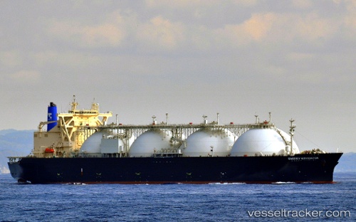
Vessel Energy Navigator IMO: 9355264, MMSI: 432634000 Lng Tanker
UTC, 32.91524, 136.68736, course: 67, speed: 12
UTC, 33.01333, 137.16667, course: -1, speed: 13
2026-01-31 12:07:03 UTC, 33.14500, 137.84666, course: -1, speed: 12
Live AIS position:
UTC. 87 nm SE of Shima, Mie),
updated 2026-01-31 12:07:03 UTC.
Find the position of the vessel Energy Navigator on the map. The latter are known coordinates and path.
marine traffic ship tracker show on live map
The current position of vessel Energy Navigator is 33.14500 lat / 137.84666 lng. Updated: 2026-01-31 12:07:03 UTCCurrently sailing under the flag of Japan
Details:
Last coordinates of the vessel:
UTC, 32.82167, 136.26500, course: -1, speed: 11UTC, 32.91524, 136.68736, course: 67, speed: 12
UTC, 33.01333, 137.16667, course: -1, speed: 13
2026-01-31 12:07:03 UTC, 33.14500, 137.84666, course: -1, speed: 12