 vesseltracker.com
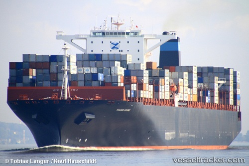
Vessel Erving IMO: 9463023, MMSI: 235084298 Container Ship
UTC, 4.91776, 98.38675, course: 136, speed: 16.7
UTC, 4.55282, 98.88544, course: 112, speed: 16.9
2026-03-04 05:23:09 UTC, 4.27745, 99.19848, course: 130, speed: 16.3
Live AIS position:
UTC. 43 nm NE of Belawan),
updated 2026-03-04 05:23:09 UTC.
Find the position of the vessel Erving on the map. The latter are known coordinates and path.
marine traffic ship tracker show on live map
The current position of vessel Erving is 4.27745 lat / 99.19848 lng. Updated: 2026-03-04 05:23:09 UTCCurrently sailing under the flag of United Kingdom
Erving built in 2011 year
Deadweight:
141377 tDetails:
Last coordinates of the vessel:
UTC, 5.17600, 98.05016, course: 125, speed: 16.2UTC, 4.91776, 98.38675, course: 136, speed: 16.7
UTC, 4.55282, 98.88544, course: 112, speed: 16.9
2026-03-04 05:23:09 UTC, 4.27745, 99.19848, course: 130, speed: 16.3