 vesseltracker.com
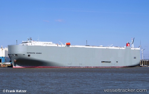
Vessel Euphrates Highway IMO: 9604926, MMSI: 373228000 Vehicles Carrier
UTC, -33.53305, -71.69272, course: 39, speed: 7.6
UTC, -33.56180, -71.71861, course: 38, speed: 7.1
2026-02-11 03:43:54 UTC, -33.59841, -71.75784, course: 207, speed: 6.6
Live AIS position:
UTC. Near San Antonio),
updated 2026-02-11 03:43:54 UTC.
Find the position of the vessel Euphrates Highway on the map. The latter are known coordinates and path.
marine traffic ship tracker show on live map
The current position of vessel Euphrates Highway is -33.59841 lat / -71.75784 lng. Updated: 2026-02-11 03:43:54 UTCCurrently sailing under the flag of Panama
Euphrates Highway built in 2012 year
Deadweight:
18668 tDetails:
Last coordinates of the vessel:
UTC, -33.60550, -71.67240, course: 179, speed: 2.4UTC, -33.53305, -71.69272, course: 39, speed: 7.6
UTC, -33.56180, -71.71861, course: 38, speed: 7.1
2026-02-11 03:43:54 UTC, -33.59841, -71.75784, course: 207, speed: 6.6