 vesseltracker.com
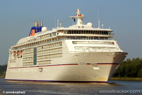
Vessel Europa 2 IMO: 9616230, MMSI: 229378000 Cruise Ship
UTC, -6.46833, -153.05167, course: -1, speed: 16
UTC, -7.19833, -152.97166, course: -1, speed: 15
2026-02-11 01:38:57 UTC, -7.53973, -152.93285, course: 169, speed: 14.2
Live AIS position:
UTC. 316 nm E of Penrhyn Island),
updated 2026-02-11 01:38:57 UTC.
Find the position of the vessel Europa 2 on the map. The latter are known coordinates and path.
marine traffic ship tracker show on live map
The current position of vessel Europa 2 is -7.53973 lat / -152.93285 lng. Updated: 2026-02-11 01:38:57 UTCCurrently sailing under the flag of Malta
Europa 2 built in 2013 year
Deadweight:
5285 tDetails:
Last coordinates of the vessel:
UTC, -5.97628, -153.10672, course: 168, speed: 16.1UTC, -6.46833, -153.05167, course: -1, speed: 16
UTC, -7.19833, -152.97166, course: -1, speed: 15
2026-02-11 01:38:57 UTC, -7.53973, -152.93285, course: 169, speed: 14.2