 vesseltracker.com
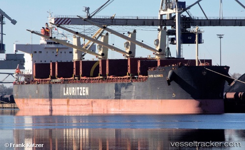
Vessel Ever Alliance IMO: 9423255, MMSI: 351928000 Bulk Carrier
UTC, 41.33147, -129.27065, course: 174, speed: 7.9
UTC, 41.19718, -129.22185, course: 168, speed: 8.4
2026-01-28 17:32:49 UTC, 40.90228, -129.14424, course: 172, speed: 8.3
Live AIS position:
UTC. 150 nm N of Volcano),
updated 2026-01-28 17:32:49 UTC.
Find the position of the vessel Ever Alliance on the map. The latter are known coordinates and path.
marine traffic ship tracker show on live map
The current position of vessel Ever Alliance is 40.90228 lat / -129.14424 lng. Updated: 2026-01-28 17:32:49 UTCDetails:
Last coordinates of the vessel:
UTC, 41.70887, -129.40919, course: 181, speed: 7.7UTC, 41.33147, -129.27065, course: 174, speed: 7.9
UTC, 41.19718, -129.22185, course: 168, speed: 8.4
2026-01-28 17:32:49 UTC, 40.90228, -129.14424, course: 172, speed: 8.3