 vesseltracker.com
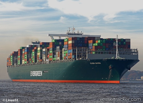
Vessel EVER GIVEN IMO: 9811000, MMSI: 353136000 Container Ship
UTC, 8.91758, 108.66765, course: 43, speed: 16.8
UTC, 8.91758, 108.66765, course: 43, speed: 16.8
2026-03-03 19:58:51 UTC, 9.30257, 109.00753, course: 45, speed: 17.1
Live AIS position:
UTC. 54 nm N of Dai Hung (Tandem Load)),
updated 2026-03-03 19:58:51 UTC.
Find the position of the vessel EVER GIVEN on the map. The latter are known coordinates and path.
marine traffic ship tracker show on live map
The current position of vessel EVER GIVEN is 9.30257 lat / 109.00753 lng. Updated: 2026-03-03 19:58:51 UTCCurrently sailing under the flag of Panama
EVER GIVEN built in 2018 year
Deadweight:
199692 tDetails:
Last coordinates of the vessel:
UTC, 8.41396, 108.26152, course: 38, speed: 15.6UTC, 8.91758, 108.66765, course: 43, speed: 16.8
UTC, 8.91758, 108.66765, course: 43, speed: 16.8
2026-03-03 19:58:51 UTC, 9.30257, 109.00753, course: 45, speed: 17.1