 vesseltracker.com
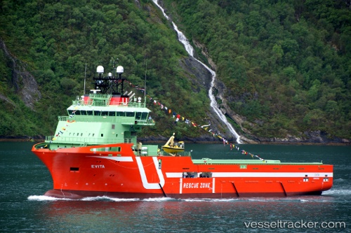
Vessel Evita Ii IMO: 9649562, MMSI: 209264000 Offshore Tug Supply Ship
UTC, -21.86181, -41.01810, course: 151, speed: 0
UTC, -21.86182, -41.01811, course: 151, speed: 0
2026-02-12 00:14:30 UTC, -21.85598, -41.01061, course: 61, speed: 0
Live AIS position:
UTC. Near PORTO DO ACU),
updated 2026-02-12 00:14:30 UTC.
Find the position of the vessel Evita Ii on the map. The latter are known coordinates and path.
marine traffic ship tracker show on live map
The current position of vessel Evita Ii is -21.85598 lat / -41.01061 lng. Updated: 2026-02-12 00:14:30 UTCCurrently sailing under the flag of Cyprus
Evita Ii built in 2012 year
Deadweight:
4500 tDetails:
Last coordinates of the vessel:
UTC, -21.86182, -41.01809, course: 152, speed: 0UTC, -21.86181, -41.01810, course: 151, speed: 0
UTC, -21.86182, -41.01811, course: 151, speed: 0
2026-02-12 00:14:30 UTC, -21.85598, -41.01061, course: 61, speed: 0