 vesseltracker.com
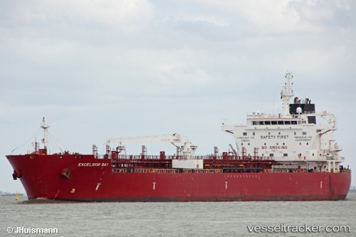
Vessel Excelsior Bay IMO: 9697612, MMSI: 538005186 Chemical Oil Products Tanker
UTC, 21.26285, -72.58578, course: 340, speed: 14.7
UTC, 21.71822, -72.75471, course: 341, speed: 14.7
2026-02-12 15:42:16 UTC, 22.09672, -72.49293, course: 40, speed: 14.6
Live AIS position:
UTC. 34 nm SE of Abraham Bay),
updated 2026-02-12 15:42:16 UTC.
Find the position of the vessel Excelsior Bay on the map. The latter are known coordinates and path.
marine traffic ship tracker show on live map
The current position of vessel Excelsior Bay is 22.09672 lat / -72.49293 lng. Updated: 2026-02-12 15:42:16 UTCCurrently sailing under the flag of Marshall Is
Details:
Last coordinates of the vessel:
UTC, 20.94666, -72.57641, course: 50, speed: 13.9UTC, 21.26285, -72.58578, course: 340, speed: 14.7
UTC, 21.71822, -72.75471, course: 341, speed: 14.7
2026-02-12 15:42:16 UTC, 22.09672, -72.49293, course: 40, speed: 14.6