 vesseltracker.com
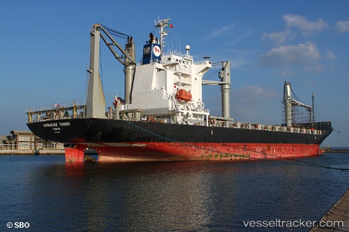
Vessel FERDINANDA S IMO: 9445019, MMSI: 255805603 Container Ship
UTC, 38.62874, -9.49587, course: 274, speed: 12.8
UTC, 39.07445, -9.73838, course: 350, speed: 12.9
2026-02-01 01:54:21 UTC, 39.38034, -9.75192, course: 350, speed: 13.1
Live AIS position:
UTC. 18 nm W of PENICHE),
updated 2026-02-01 01:54:21 UTC.
Find the position of the vessel FERDINANDA S on the map. The latter are known coordinates and path.
marine traffic ship tracker show on live map
The current position of vessel FERDINANDA S is 39.38034 lat / -9.75192 lng. Updated: 2026-02-01 01:54:21 UTCCurrently sailing under the flag of Portugal (MAR)
FERDINANDA S built in 2008 year
Deadweight:
21464 tDetails:
Last coordinates of the vessel:
UTC, 38.69782, -9.17448, course: 77, speed: 0UTC, 38.62874, -9.49587, course: 274, speed: 12.8
UTC, 39.07445, -9.73838, course: 350, speed: 12.9
2026-02-01 01:54:21 UTC, 39.38034, -9.75192, course: 350, speed: 13.1