 vesseltracker.com
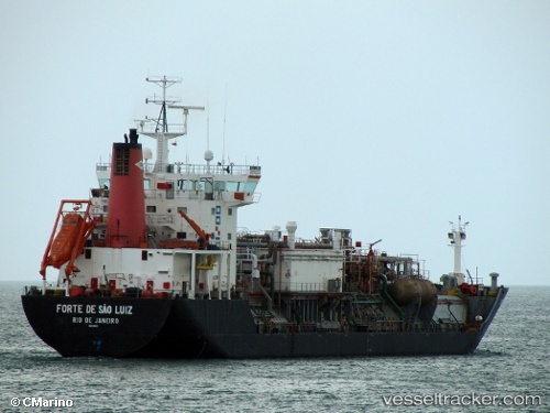
Vessel FORTE DE SAO LUIZ IMO: 9204922, MMSI: 710000026 LPG Tanker
Live AIS position:
UTC. 182 nm SE of Cidade de Angra dos Reis FPSO),
updated 2025-11-05 03:17:19 UTC.
Find the position of the vessel FORTE DE SAO LUIZ on the map. The latter are known coordinates and path.
marine traffic ship tracker show on live map
The current position of vessel FORTE DE SAO LUIZ is -26.66763 lat / -39.70566 lng. Updated: 2025-11-05 03:17:19 UTCCurrently sailing under the flag of Brazil
FORTE DE SAO LUIZ built in 2000 year
Deadweight:
8250 tDetails:
Last coordinates of the vessel:
2025-11-05 03:17:19 UTC, -26.66763, -39.70566, course: 55, speed: 0.3