 vesseltracker.com
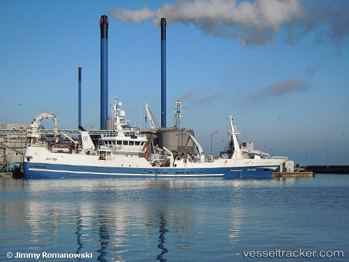
Vessel Father Mckee IMO: 9295878, MMSI: 250513000 Fish Carrier
UTC, 54.63076, -8.43971, course: 313, speed: 0
UTC, 54.63078, -8.43980, course: 313, speed: 0
2026-02-13 05:59:00 UTC, 54.63075, -8.43977, course: 313, speed: 0
Live AIS position:
UTC. Near KILLYBEGS),
updated 2026-02-13 05:59:00 UTC.
Find the position of the vessel Father Mckee on the map. The latter are known coordinates and path.
marine traffic ship tracker show on live map
The current position of vessel Father Mckee is 54.63075 lat / -8.43977 lng. Updated: 2026-02-13 05:59:00 UTCCurrently sailing under the flag of Ireland
Father Mckee built in 2004 year
Details:
Last coordinates of the vessel:
UTC, 54.63076, -8.43977, course: 312, speed: 0UTC, 54.63076, -8.43971, course: 313, speed: 0
UTC, 54.63078, -8.43980, course: 313, speed: 0
2026-02-13 05:59:00 UTC, 54.63075, -8.43977, course: 313, speed: 0