 vesseltracker.com
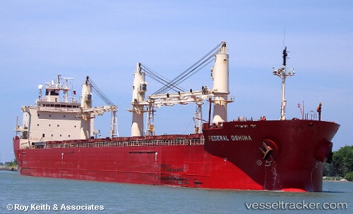
Vessel Federal Oshima IMO: 9200330, MMSI: 538006783 Bulk Carrier
UTC, 58.14064, 1.54143, course: 263, speed: 8.2
UTC, 58.13448, 1.18614, course: 265, speed: 8.4
2026-02-14 17:42:40 UTC, 58.13448, 1.18614, course: 265, speed: 8.4
Live AIS position:
UTC. Near Alba Oil Field),
updated 2026-02-14 17:42:40 UTC.
Find the position of the vessel Federal Oshima on the map. The latter are known coordinates and path.
marine traffic ship tracker show on live map
The current position of vessel Federal Oshima is 58.13448 lat / 1.18614 lng. Updated: 2026-02-14 17:42:40 UTCDetails:
Last coordinates of the vessel:
UTC, 58.14064, 1.54143, course: 263, speed: 8.2UTC, 58.14064, 1.54143, course: 263, speed: 8.2
UTC, 58.13448, 1.18614, course: 265, speed: 8.4
2026-02-14 17:42:40 UTC, 58.13448, 1.18614, course: 265, speed: 8.4