 vesseltracker.com
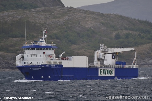
Vessel Feed Tromsoe IMO: 9157832, MMSI: 259506000 Palletized Cargo Ship
UTC, 70.29136, 21.39113, course: 53, speed: 9.5
UTC, 70.41095, 21.87362, course: 77, speed: 9.2
2026-02-14 19:53:25 UTC, 70.50885, 22.88900, course: 75, speed: 9.8
Live AIS position:
UTC. Near Kårhamn),
updated 2026-02-14 19:53:25 UTC.
Find the position of the vessel Feed Tromsoe on the map. The latter are known coordinates and path.
marine traffic ship tracker show on live map
The current position of vessel Feed Tromsoe is 70.50885 lat / 22.88900 lng. Updated: 2026-02-14 19:53:25 UTCCurrently sailing under the flag of Norway
Feed Tromsoe built in 1998 year
Deadweight:
1725 tDetails:
Last coordinates of the vessel:
UTC, 70.02097, 20.53134, course: 94, speed: 10.1UTC, 70.29136, 21.39113, course: 53, speed: 9.5
UTC, 70.41095, 21.87362, course: 77, speed: 9.2
2026-02-14 19:53:25 UTC, 70.50885, 22.88900, course: 75, speed: 9.8