 vesseltracker.com
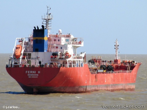
Vessel Ferni H IMO: 9502441, MMSI: 636014263 Chemical Oil Products Tanker
UTC, -37.34667, -56.39667, course: -1, speed: 9
UTC, -36.91500, -56.07667, course: -1, speed: 10
2026-02-01 06:26:29 UTC, -36.58958, -55.88580, course: 25, speed: 11
Live AIS position:
UTC. 40 nm E of Punta Medanos),
updated 2026-02-01 06:26:29 UTC.
Find the position of the vessel Ferni H on the map. The latter are known coordinates and path.
marine traffic ship tracker show on live map
The current position of vessel Ferni H is -36.58958 lat / -55.88580 lng. Updated: 2026-02-01 06:26:29 UTCDetails:
Last coordinates of the vessel:
UTC, -37.59500, -56.57833, course: -1, speed: 1UTC, -37.34667, -56.39667, course: -1, speed: 9
UTC, -36.91500, -56.07667, course: -1, speed: 10
2026-02-01 06:26:29 UTC, -36.58958, -55.88580, course: 25, speed: 11