 vesseltracker.com
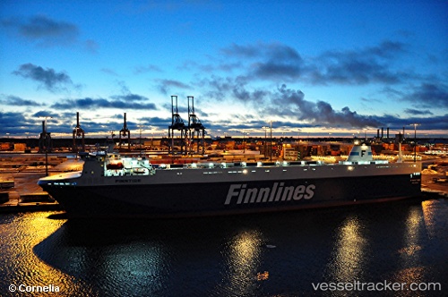
Vessel Finntide IMO: 9468920, MMSI: 230631000 Ro Ro Cargo Ship
UTC, 54.53298, 18.52333, course: 57, speed: 0
UTC, 54.53297, 18.52332, course: 57, speed: 0
2026-01-31 16:03:09 UTC, 54.53296, 18.52333, course: 57, speed: 0
Live AIS position:
UTC. Near Gdynia),
updated 2026-01-31 16:03:09 UTC.
Find the position of the vessel Finntide on the map. The latter are known coordinates and path.
marine traffic ship tracker show on live map
The current position of vessel Finntide is 54.53296 lat / 18.52333 lng. Updated: 2026-01-31 16:03:09 UTCCurrently sailing under the flag of Finland
Finntide built in 2012 year
Deadweight:
11029 tDetails:
Last coordinates of the vessel:
UTC, 54.53295, 18.52333, course: 57, speed: 0UTC, 54.53298, 18.52333, course: 57, speed: 0
UTC, 54.53297, 18.52332, course: 57, speed: 0
2026-01-31 16:03:09 UTC, 54.53296, 18.52333, course: 57, speed: 0