 vesseltracker.com
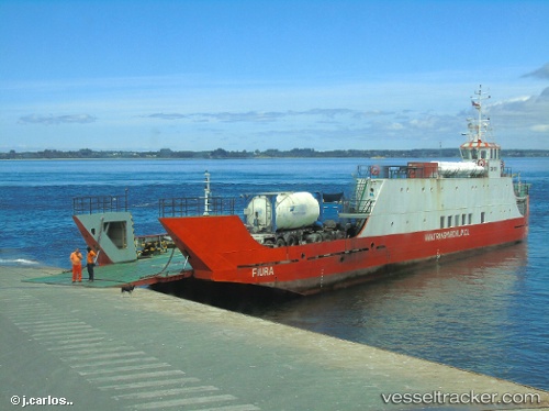
Vessel Fiura IMO: 8837863, MMSI: 725002850 Passenger Ro Ro Cargo Ship
UTC, -37.07287, -73.15451, course: -1, speed: 1.9
UTC, -37.06681, -73.15341, course: -1, speed: 0.5
2026-01-28 23:59:38 UTC, -37.06650, -73.15355, course: -1, speed: 0
Live AIS position:
UTC. Near Lota),
updated 2026-01-28 23:59:38 UTC.
Find the position of the vessel Fiura on the map. The latter are known coordinates and path.
marine traffic ship tracker show on live map
The current position of vessel Fiura is -37.06650 lat / -73.15355 lng. Updated: 2026-01-28 23:59:38 UTCDetails:
Last coordinates of the vessel:
UTC, -37.06654, -73.47082, course: -1, speed: 8.1UTC, -37.07287, -73.15451, course: -1, speed: 1.9
UTC, -37.06681, -73.15341, course: -1, speed: 0.5
2026-01-28 23:59:38 UTC, -37.06650, -73.15355, course: -1, speed: 0