 vesseltracker.com
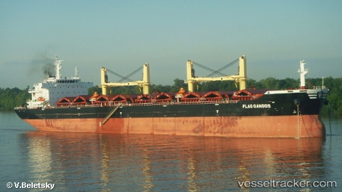
Vessel Flag Gangos IMO: 9643908, MMSI: 229376000 Bulk Carrier
UTC, 40.21515, 121.59754, course: 67, speed: 0
UTC, 40.21881, 121.59997, course: 176, speed: 0.3
2026-01-27 10:38:25 UTC, 40.21969, 121.60320, course: 231, speed: 0.4
Live AIS position:
UTC. 24 nm W of Bayuquan),
updated 2026-01-27 10:38:25 UTC.
Find the position of the vessel Flag Gangos on the map. The latter are known coordinates and path.
marine traffic ship tracker show on live map
The current position of vessel Flag Gangos is 40.21969 lat / 121.60320 lng. Updated: 2026-01-27 10:38:25 UTCDetails:
Last coordinates of the vessel:
UTC, 40.21506, 121.59904, course: 56, speed: 0.1UTC, 40.21515, 121.59754, course: 67, speed: 0
UTC, 40.21881, 121.59997, course: 176, speed: 0.3
2026-01-27 10:38:25 UTC, 40.21969, 121.60320, course: 231, speed: 0.4