 vesseltracker.com
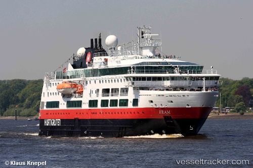
Vessel Fram IMO: 9370018, MMSI: 258932000 Cruise Ship
UTC, -52.61084, -67.90027, course: 75, speed: 12.3
UTC, -52.54777, -67.39116, course: 75, speed: 11.1
2026-02-08 12:17:15 UTC, -52.45387, -66.63821, course: 80, speed: 10.1
Live AIS position:
UTC. 53 nm NW of Naschel),
updated 2026-02-08 12:17:15 UTC.
Find the position of the vessel Fram on the map. The latter are known coordinates and path.
marine traffic ship tracker show on live map
The current position of vessel Fram is -52.45387 lat / -66.63821 lng. Updated: 2026-02-08 12:17:15 UTCCurrently sailing under the flag of Norway
Fram built in 2007 year
Deadweight:
984 tDetails:
Last coordinates of the vessel:
UTC, -52.53833, -68.42833, course: -1, speed: 12UTC, -52.61084, -67.90027, course: 75, speed: 12.3
UTC, -52.54777, -67.39116, course: 75, speed: 11.1
2026-02-08 12:17:15 UTC, -52.45387, -66.63821, course: 80, speed: 10.1