 vesseltracker.com
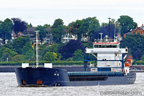
Vessel Fri Tide IMO: 9195676, MMSI: 309186000 General Cargo Ship
UTC, 53.70902, -0.36520, course: 247, speed: 0
UTC, 53.70901, -0.36529, course: 246, speed: 0
2026-02-06 05:44:15 UTC, 53.70898, -0.36522, course: 246, speed: 0
Live AIS position:
UTC. Near New Holland),
updated 2026-02-06 05:44:15 UTC.
Find the position of the vessel Fri Tide on the map. The latter are known coordinates and path.
marine traffic ship tracker show on live map
The current position of vessel Fri Tide is 53.70898 lat / -0.36522 lng. Updated: 2026-02-06 05:44:15 UTCCurrently sailing under the flag of Bahamas
Fri Tide built in 2000 year
Deadweight:
3400 tDetails:
Last coordinates of the vessel:
UTC, 53.70902, -0.36522, course: 246, speed: 0UTC, 53.70902, -0.36520, course: 247, speed: 0
UTC, 53.70901, -0.36529, course: 246, speed: 0
2026-02-06 05:44:15 UTC, 53.70898, -0.36522, course: 246, speed: 0