 vesseltracker.com
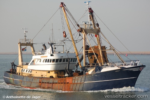
Vessel Friendship IMO: 7904827, MMSI: 372906000 Salvage Ship
UTC, 53.36382, 5.22110, course: -1, speed: 0
UTC, 53.36385, 5.22113, course: -1, speed: 0
2026-02-05 11:47:37 UTC, 53.36388, 5.22112, course: -1, speed: 0
Live AIS position:
UTC. Near TERSCHELLING),
updated 2026-02-05 11:47:37 UTC.
Find the position of the vessel Friendship on the map. The latter are known coordinates and path.
marine traffic ship tracker show on live map
The current position of vessel Friendship is 53.36388 lat / 5.22112 lng. Updated: 2026-02-05 11:47:37 UTCCurrently sailing under the flag of Panama
Friendship built in 1980 year
Deadweight:
180 tDetails:
Last coordinates of the vessel:
UTC, 53.36384, 5.22113, course: -1, speed: 0UTC, 53.36382, 5.22110, course: -1, speed: 0
UTC, 53.36385, 5.22113, course: -1, speed: 0
2026-02-05 11:47:37 UTC, 53.36388, 5.22112, course: -1, speed: 0