 vesseltracker.com
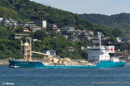
Vessel Fujimaru IMO: 9222675, MMSI: 431601989 Cement Carrier
UTC, 37.09107, 136.96835, course: 287, speed: 0
UTC, 37.09157, 136.96828, course: 255, speed: 0.2
2026-01-30 20:09:34 UTC, 37.09143, 136.96837, course: 268, speed: 0.2
Live AIS position:
UTC. Near Nanao),
updated 2026-01-30 20:09:34 UTC.
Find the position of the vessel Fujimaru on the map. The latter are known coordinates and path.
marine traffic ship tracker show on live map
The current position of vessel Fujimaru is 37.09143 lat / 136.96837 lng. Updated: 2026-01-30 20:09:34 UTCCurrently sailing under the flag of Japan
Details:
Last coordinates of the vessel:
UTC, 37.09114, 136.96837, course: 279, speed: 0UTC, 37.09107, 136.96835, course: 287, speed: 0
UTC, 37.09157, 136.96828, course: 255, speed: 0.2
2026-01-30 20:09:34 UTC, 37.09143, 136.96837, course: 268, speed: 0.2