 vesseltracker.com
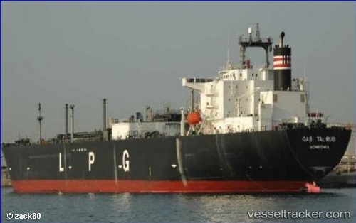
Vessel GAS TAURUS IMO: 9710385, MMSI: 636021228 LPG Tanker
Live AIS position:
UTC. Near Huangpu New Port),
updated 2026-01-05 10:20:15 UTC.
Find the position of the vessel GAS TAURUS on the map. The latter are known coordinates and path.
marine traffic ship tracker show on live map
The current position of vessel GAS TAURUS is 23.08327 lat / 113.47831 lng. Updated: 2026-01-05 10:20:15 UTCCurrently sailing under the flag of Liberia
GAS TAURUS built in 2016 year
Deadweight:
53765 tDetails:
Last coordinates of the vessel:
2026-01-05 10:20:15 UTC, 23.08327, 113.47831, course: -1, speed: 0