 vesseltracker.com
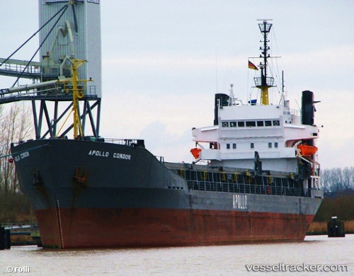
Vessel GHADA A IMO: 7126102, MMSI: 671016100 General Cargo Ship
UTC, 10.43667, 44.99500, course: -1, speed: 0
UTC, 10.43667, 44.99500, course: -1, speed: 0
2026-02-11 07:43:37 UTC, 10.43667, 44.99500, course: -1, speed: 0
Live AIS position:
UTC. Near Berbera),
updated 2026-02-11 07:43:37 UTC.
Find the position of the vessel GHADA A on the map. The latter are known coordinates and path.
marine traffic ship tracker show on live map
The current position of vessel GHADA A is 10.43667 lat / 44.99500 lng. Updated: 2026-02-11 07:43:37 UTCCurrently sailing under the flag of Togo
GHADA A built in 1972 year
Deadweight:
6341 tDetails:
Last coordinates of the vessel:
UTC, 10.43667, 44.99500, course: -1, speed: 0UTC, 10.43667, 44.99500, course: -1, speed: 0
UTC, 10.43667, 44.99500, course: -1, speed: 0
2026-02-11 07:43:37 UTC, 10.43667, 44.99500, course: -1, speed: 0