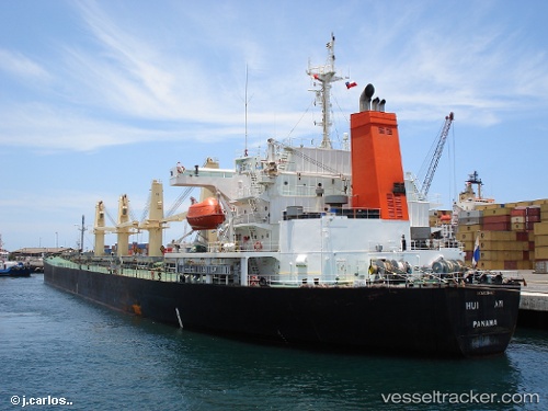
vessel GIVING IMO: 9159402, Bulk Carrier vesseltracker.com
Vessel GIVING IMO: 9159402, Bulk Carrier
MMSI: 314589000 callsign: 8PBG6 size: x

Find the position of the vessel GIVING on the map. The latter are known coordinates and path.

marine traffic ship tracker show on live map

The current position of vessel GIVING is 36.9541 lat / 23.8217 lng. Updated: 2025-07-15 05:33:18 UTC

Currently sailing under the flag of Barbados

GIVING built in 1997 year

Deadweight:
45428 t

Details:


Last coordinates of the vessel:
UTC, 36.4695, 23.3573, course: 35, speed: 12.9
UTC, 36.6009, 23.4988, course: 43, speed: 12.6
UTC, 36.7604, 23.672, course: 38, speed: 12.3
2025-07-15 05:33:18 UTC, 36.9541, 23.8217, course: 24, speed: 12.4

Track of the vessel in the last 14 days


Most frequent ports a vessels calls at GIVING (314589000):

Mina Abd Allah, traffic: 31
Mina Al Ahmadi, traffic: 23
Mina Az Zawr, traffic: 12
Chittagong, traffic: 1
Sharjah, traffic: 1

Link to the map:


Find another ship

GIVING (314589000) last ports (portcalls and passsages)

Sharjah | 2022-03-24 12:50:58
Mina Az Zawr | 2022-03-19 09:21:10
Mina Abd Allah | 2022-03-14 12:51:12
Mina Abd Allah | 2022-02-26 12:10:55
Mina Abd Allah | 2022-02-20 21:10:12
Mina Abd Allah | 2022-02-20 19:00:09
Mina Az Zawr | 2022-02-05 21:46:54
Mina Abd Allah | 2022-02-05 20:50:21
Mina Abd Allah | 2022-01-19 18:12:02
Mina Abd Allah | 2022-01-06 19:40:51
Mina Abd Allah | 2022-01-06 19:30:02
Mina Al Ahmadi | 2022-01-06 19:20:20
Mina Az Zawr | 2022-01-03 12:45:01
Mina Al Ahmadi | 2022-01-03 12:30:45
Mina Abd Allah | 2022-01-03 12:15:01
Mina Az Zawr | 2021-12-14 16:40:01
Chittagong | 2021-09-30 16:12:11