 vesseltracker.com
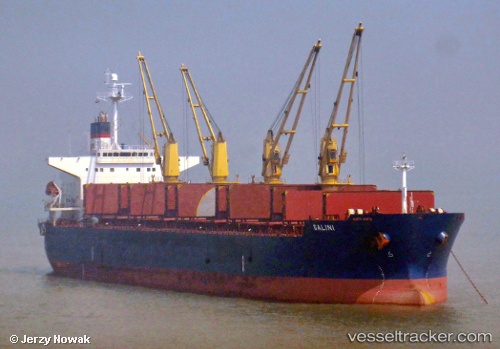
Vessel Galini IMO: 9311517, MMSI: 240311000 Bulk Carrier
UTC, 2.45521, 75.14893, course: 67, speed: 9.3
UTC, 2.52670, 75.27592, course: 64, speed: 8.9
2026-02-01 13:51:18 UTC, 2.78205, 75.73681, course: 64, speed: 9.5
Live AIS position:
UTC. 155 nm NE of Hithadhoo),
updated 2026-02-01 13:51:18 UTC.
Find the position of the vessel Galini on the map. The latter are known coordinates and path.
marine traffic ship tracker show on live map
The current position of vessel Galini is 2.78205 lat / 75.73681 lng. Updated: 2026-02-01 13:51:18 UTCDetails:
Last coordinates of the vessel:
UTC, 2.31739, 74.89820, course: 66, speed: 8.8UTC, 2.45521, 75.14893, course: 67, speed: 9.3
UTC, 2.52670, 75.27592, course: 64, speed: 8.9
2026-02-01 13:51:18 UTC, 2.78205, 75.73681, course: 64, speed: 9.5