 vesseltracker.com
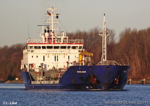
Vessel Gazpromneft Omsk IMO: 9418509, MMSI: 273371330 Oil Products Tanker
UTC, 46.64326, 142.51764, course: 315, speed: 0
UTC, 46.64330, 142.51768, course: 313, speed: 0.1
2026-01-31 03:49:40 UTC, 46.64331, 142.51775, course: 311, speed: 0
Live AIS position:
UTC. Near ANIVA),
updated 2026-01-31 03:49:40 UTC.
Find the position of the vessel Gazpromneft Omsk on the map. The latter are known coordinates and path.
marine traffic ship tracker show on live map
The current position of vessel Gazpromneft Omsk is 46.64331 lat / 142.51775 lng. Updated: 2026-01-31 03:49:40 UTCCurrently sailing under the flag of Russia
Gazpromneft Omsk built in 2008 year
Deadweight:
5373 tDetails:
Last coordinates of the vessel:
UTC, 46.64326, 142.51758, course: 317, speed: 0.1UTC, 46.64326, 142.51764, course: 315, speed: 0
UTC, 46.64330, 142.51768, course: 313, speed: 0.1
2026-01-31 03:49:40 UTC, 46.64331, 142.51775, course: 311, speed: 0