 vesseltracker.com
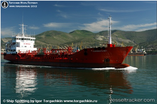
Vessel Gazpromneft West IMO: 9031636, MMSI: 273334320 Chemical Oil Products Tanker
UTC, 42.78933, 132.92279, course: 337, speed: 0.2
UTC, 42.78929, 132.92242, course: 350, speed: 0.1
2026-01-30 03:25:44 UTC, 42.78936, 132.92271, course: 346, speed: 0.1
Live AIS position:
UTC. Near Nakhodka),
updated 2026-01-30 03:25:44 UTC.
Find the position of the vessel Gazpromneft West on the map. The latter are known coordinates and path.
marine traffic ship tracker show on live map
The current position of vessel Gazpromneft West is 42.78936 lat / 132.92271 lng. Updated: 2026-01-30 03:25:44 UTCCurrently sailing under the flag of Russia
Gazpromneft West built in 1992 year
Deadweight:
2778 tDetails:
Last coordinates of the vessel:
UTC, 42.78933, 132.92279, course: 337, speed: 0.2UTC, 42.78933, 132.92279, course: 337, speed: 0.2
UTC, 42.78929, 132.92242, course: 350, speed: 0.1
2026-01-30 03:25:44 UTC, 42.78936, 132.92271, course: 346, speed: 0.1