 vesseltracker.com
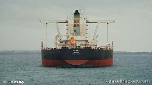
Vessel Gemma IMO: 9602784, MMSI: 247302100 Ore Carrier
UTC, 9.54833, 111.83667, course: -1, speed: 13
UTC, 9.26897, 111.54404, course: 205, speed: 12
2026-01-30 17:51:55 UTC, 8.90025, 111.39160, course: 203, speed: 13.1
Live AIS position:
UTC. 90 nm NE of Colomadu),
updated 2026-01-30 17:51:55 UTC.
Find the position of the vessel Gemma on the map. The latter are known coordinates and path.
marine traffic ship tracker show on live map
The current position of vessel Gemma is 8.90025 lat / 111.39160 lng. Updated: 2026-01-30 17:51:55 UTCCurrently sailing under the flag of Italy
Gemma built in 2012 year
Deadweight:
313049 tDetails:
Last coordinates of the vessel:
UTC, 9.86167, 112.22500, course: -1, speed: 13UTC, 9.54833, 111.83667, course: -1, speed: 13
UTC, 9.26897, 111.54404, course: 205, speed: 12
2026-01-30 17:51:55 UTC, 8.90025, 111.39160, course: 203, speed: 13.1