 vesseltracker.com
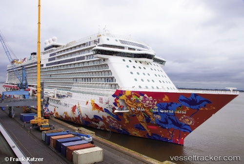
Vessel Genting Dream IMO: 9733105, MMSI: 311000319 Cruise Ship
UTC, 1.26725, 103.86063, course: 325, speed: 0
UTC, 1.16408, 103.67811, course: 314, speed: 16.9
2026-02-01 14:27:29 UTC, 1.38073, 103.21997, course: 315, speed: 10.6
Live AIS position:
UTC. 20 nm W of Tanjong Bin),
updated 2026-02-01 14:27:29 UTC.
Find the position of the vessel Genting Dream on the map. The latter are known coordinates and path.
marine traffic ship tracker show on live map
The current position of vessel Genting Dream is 1.38073 lat / 103.21997 lng. Updated: 2026-02-01 14:27:29 UTCDetails:
Last coordinates of the vessel:
UTC, 1.26724, 103.86064, course: 325, speed: 0UTC, 1.26725, 103.86063, course: 325, speed: 0
UTC, 1.16408, 103.67811, course: 314, speed: 16.9
2026-02-01 14:27:29 UTC, 1.38073, 103.21997, course: 315, speed: 10.6