 vesseltracker.com
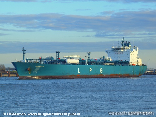
Find the position of the vessel George N on the map. The latter are known coordinates and path.
marine traffic ship tracker show on live map
The current position of vessel George N is 8.06970 lat / -79.36356 lng. Updated: 2025-10-30 11:58:42 UTCCurrently sailing under the flag of Liberia
George N built in 2008 year
Deadweight:
43601 tDetails:
Last coordinates of the vessel:
UTC, 7.38659, -79.41588, course: 10, speed: 14.3UTC, 7.78614, -79.36892, course: 3, speed: 15
UTC, 7.83669, -79.36826, course: 3, speed: 11.5
2025-10-30 11:58:42 UTC, 8.06970, -79.36356, course: 0, speed: 9