 vesseltracker.com
Find the position of the vessel George R Pearkes on the map. The latter are known coordinates and path.
marine traffic ship tracker show on live map
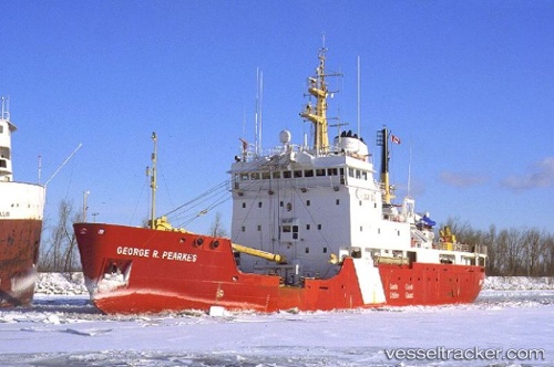
The current position of vessel George R Pearkes is 49.30456 lat / -54.83271 lng. Updated: 2025-10-30 10:50:39 UTCCurrently sailing under the flag of Canada
George R Pearkes built in 1986 year
Deadweight:
1689 tDetails:
Last coordinates of the vessel:
UTC, 49.30434, -54.83258, course: 232, speed: 0UTC, 49.30447, -54.83263, course: 239, speed: 0.1
UTC, 49.30464, -54.83284, course: 198, speed: 0
2025-10-30 10:50:39 UTC, 49.30456, -54.83271, course: 213, speed: 0
Track of the vessel in the last 14 days
The ship also appears on the maps: