 vesseltracker.com
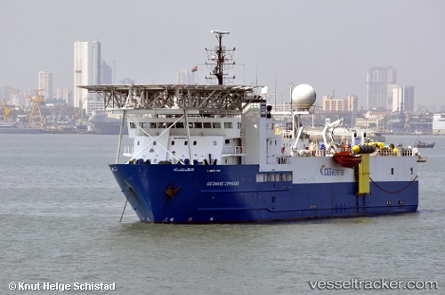
Vessel Geowave Commander IMO: 9183867, MMSI: 258830000 Research Vessel
Live AIS position:
UTC. Near Måløy),
updated 2024-03-05 13:41:46 UTC.
Find the position of the vessel Geowave Commander on the map. The latter are known coordinates and path.
marine traffic ship tracker show on live map
The current position of vessel Geowave Commander is 61.91739 lat / 5.11265 lng. Updated: 2024-03-05 13:41:46 UTCCurrently sailing under the flag of Norway
Geowave Commander built in 1998 year
Deadweight:
3628 tDetails:
Last coordinates of the vessel:
2024-03-05 13:41:46 UTC, 61.91739, 5.11265, course: 0, speed: 0