 vesseltracker.com
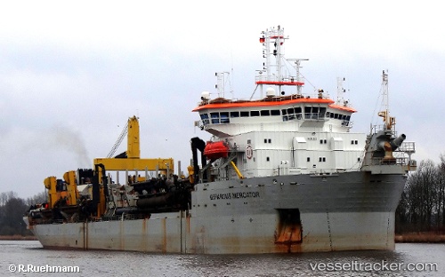
Vessel Gerardus Mercator IMO: 9119335, MMSI: 645309000 Hopper Dredger
Live AIS position:
UTC. Near HIDD),
updated 2026-01-05 10:51:18 UTC.
Find the position of the vessel Gerardus Mercator on the map. The latter are known coordinates and path.
marine traffic ship tracker show on live map
The current position of vessel Gerardus Mercator is 26.19372 lat / 50.67276 lng. Updated: 2026-01-05 10:51:18 UTCCurrently sailing under the flag of Mauritius
Gerardus Mercator built in 1997 year
Deadweight:
20333 tDetails:
Last coordinates of the vessel:
2026-01-05 10:51:18 UTC, 26.19372, 50.67276, course: 333, speed: 0