 vesseltracker.com
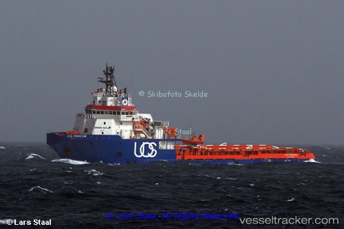
Vessel Gh Freedom IMO: 9439929, MMSI: 305591000 Offshore Tug Supply Ship
UTC, 33.95205, 12.69188, course: 214, speed: 0.1
UTC, 33.94833, 12.69333, course: -1, speed: 0
2026-02-11 01:27:56 UTC, 33.94167, 12.68500, course: -1, speed: 0
Live AIS position:
UTC. 41 nm E of Didon),
updated 2026-02-11 01:27:56 UTC.
Find the position of the vessel Gh Freedom on the map. The latter are known coordinates and path.
marine traffic ship tracker show on live map
The current position of vessel Gh Freedom is 33.94167 lat / 12.68500 lng. Updated: 2026-02-11 01:27:56 UTCCurrently sailing under the flag of Antigua Barbuda
Gh Freedom built in 2010 year
Deadweight:
3006 tDetails:
Last coordinates of the vessel:
UTC, 33.95148, 12.69284, course: 216, speed: 0UTC, 33.95205, 12.69188, course: 214, speed: 0.1
UTC, 33.94833, 12.69333, course: -1, speed: 0
2026-02-11 01:27:56 UTC, 33.94167, 12.68500, course: -1, speed: 0