 vesseltracker.com
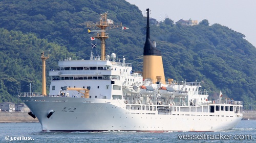
Vessel Gingamaru IMO: 9271274, MMSI: 432470000 Training Ship
UTC, 34.67947, 135.20200, course: 346, speed: 0
UTC, 34.67948, 135.20200, course: 346, speed: 0
2026-02-09 00:25:47 UTC, 34.67946, 135.20201, course: 346, speed: 0
Live AIS position:
UTC. Near Kobe),
updated 2026-02-09 00:25:47 UTC.
Find the position of the vessel Gingamaru on the map. The latter are known coordinates and path.
marine traffic ship tracker show on live map
The current position of vessel Gingamaru is 34.67946 lat / 135.20201 lng. Updated: 2026-02-09 00:25:47 UTCCurrently sailing under the flag of Japan
Gingamaru built in 2004 year
Deadweight:
3570 tDetails:
Last coordinates of the vessel:
UTC, 34.67947, 135.20200, course: 346, speed: 0UTC, 34.67947, 135.20200, course: 346, speed: 0
UTC, 34.67948, 135.20200, course: 346, speed: 0
2026-02-09 00:25:47 UTC, 34.67946, 135.20201, course: 346, speed: 0