 vesseltracker.com
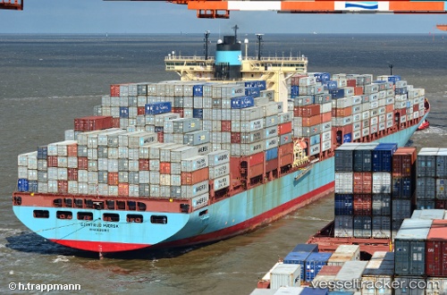
Vessel Gjertrud Maersk IMO: 9320233, MMSI: 220414000 Container Ship
UTC, 45.97357, -167.28777, course: 93, speed: 15.8
UTC, 45.95940, -166.79695, course: 93, speed: 16
2026-02-25 04:19:43 UTC, 45.90500, -165.70332, course: -1, speed: 16
Live AIS position:
UTC. 211 nm SW of Achau),
updated 2026-02-25 04:19:43 UTC.
Find the position of the vessel Gjertrud Maersk on the map. The latter are known coordinates and path.
marine traffic ship tracker show on live map
The current position of vessel Gjertrud Maersk is 45.90500 lat / -165.70332 lng. Updated: 2026-02-25 04:19:43 UTCCurrently sailing under the flag of Denmark
Gjertrud Maersk built in 2005 year
Deadweight:
115700 tDetails:
Last coordinates of the vessel:
UTC, 46.00667, -168.02499, course: -1, speed: 16UTC, 45.97357, -167.28777, course: 93, speed: 15.8
UTC, 45.95940, -166.79695, course: 93, speed: 16
2026-02-25 04:19:43 UTC, 45.90500, -165.70332, course: -1, speed: 16