 vesseltracker.com
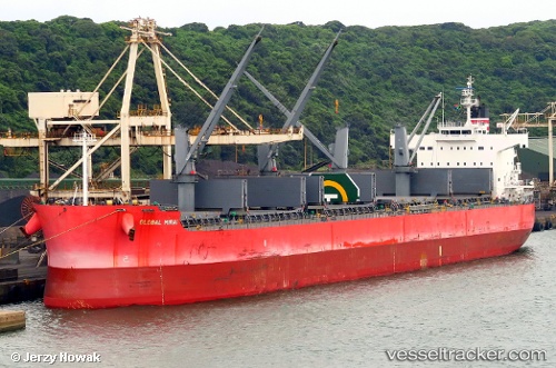
Vessel Global Mirai IMO: 9558256, MMSI: 353639000 Bulk Carrier
UTC, 15.20833, -145.28168, course: -1, speed: 11
UTC, 15.21047, -145.67139, course: 269, speed: 11.2
2026-01-24 03:43:57 UTC, 15.21342, -145.94797, course: 269, speed: 10.4
Live AIS position:
UTC. 133 nm NW of Santa Rita),
updated 2026-01-24 03:43:57 UTC.
Find the position of the vessel Global Mirai on the map. The latter are known coordinates and path.
marine traffic ship tracker show on live map
The current position of vessel Global Mirai is 15.21342 lat / -145.94797 lng. Updated: 2026-01-24 03:43:57 UTCDetails:
Last coordinates of the vessel:
UTC, 15.21037, -144.93250, course: 267, speed: 11.1UTC, 15.20833, -145.28168, course: -1, speed: 11
UTC, 15.21047, -145.67139, course: 269, speed: 11.2
2026-01-24 03:43:57 UTC, 15.21342, -145.94797, course: 269, speed: 10.4