 vesseltracker.com
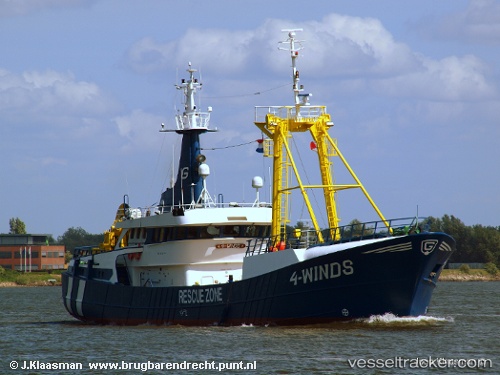
Vessel Glomar 4 WINDS IMO: 8521658, MMSI: 354498000 Standby Safety Vessel
UTC, 53.25966, 4.00425, course: 111, speed: 3.6
UTC, 53.25891, 3.99951, course: 78, speed: 3
2026-01-23 23:53:20 UTC, 53.27327, 4.09063, course: 251, speed: 5.2
Live AIS position:
UTC. 24 nm NW of Molengat),
updated 2026-01-23 23:53:20 UTC.
Find the position of the vessel Glomar 4 WINDS on the map. The latter are known coordinates and path.
marine traffic ship tracker show on live map
The current position of vessel Glomar 4 WINDS is 53.27327 lat / 4.09063 lng. Updated: 2026-01-23 23:53:20 UTCCurrently sailing under the flag of Panama
Glomar 4 WINDS built in 1986 year
Details:
Last coordinates of the vessel:
UTC, 53.25912, 4.00448, course: 98, speed: 2.2UTC, 53.25966, 4.00425, course: 111, speed: 3.6
UTC, 53.25891, 3.99951, course: 78, speed: 3
2026-01-23 23:53:20 UTC, 53.27327, 4.09063, course: 251, speed: 5.2