 vesseltracker.com
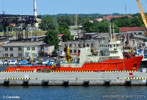
Vessel Glomar Patriot IMO: 7404176, MMSI: 353186000 Offshore Tug Supply Ship
UTC, 57.76451, 2.02319, course: 148, speed: 5.3
UTC, 57.76451, 2.02319, course: 148, speed: 5.3
2026-01-23 23:39:08 UTC, 57.36123, 2.47586, course: 146, speed: 4.7
Live AIS position:
UTC. 14 nm N of Echt),
updated 2026-01-23 23:39:08 UTC.
Find the position of the vessel Glomar Patriot on the map. The latter are known coordinates and path.
marine traffic ship tracker show on live map
The current position of vessel Glomar Patriot is 57.36123 lat / 2.47586 lng. Updated: 2026-01-23 23:39:08 UTCCurrently sailing under the flag of Panama
Glomar Patriot built in 1975 year
Deadweight:
782 tDetails:
Last coordinates of the vessel:
UTC, 58.14281, 1.67444, course: 142, speed: 6.8UTC, 57.76451, 2.02319, course: 148, speed: 5.3
UTC, 57.76451, 2.02319, course: 148, speed: 5.3
2026-01-23 23:39:08 UTC, 57.36123, 2.47586, course: 146, speed: 4.7