 vesseltracker.com
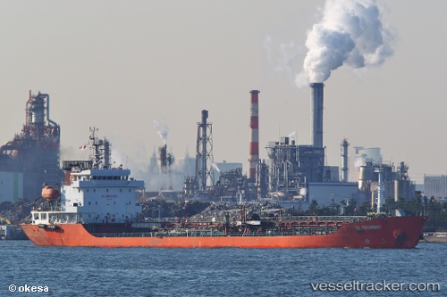
Vessel Gloriwind IMO: 9449649, MMSI: 477969100 Oil Products Tanker
UTC, 58.48667, 148.87666, course: -1, speed: 11
UTC, 58.50500, 148.68500, course: -1, speed: 10
UTC, 58.52167, 148.53168, course: -1, speed: 11
2026-01-23 21:37:15 UTC, 58.58333, 147.77667, course: -1, speed: 11
Live AIS position:
UTC. 86 nm W of Vreta Kloster),
updated 2026-01-23 21:37:15 UTC.
Find the position of the vessel Gloriwind on the map. The latter are known coordinates and path.
marine traffic ship tracker show on live map
The current position of vessel Gloriwind is 58.58333 lat / 147.77667 lng. Updated: 2026-01-23 21:37:15 UTCDetails:
Last coordinates of the vessel:
UTC, 58.44647, 149.39661, course: 282, speed: 10UTC, 58.48667, 148.87666, course: -1, speed: 11
UTC, 58.50500, 148.68500, course: -1, speed: 10
UTC, 58.52167, 148.53168, course: -1, speed: 11
2026-01-23 21:37:15 UTC, 58.58333, 147.77667, course: -1, speed: 11