 vesseltracker.com
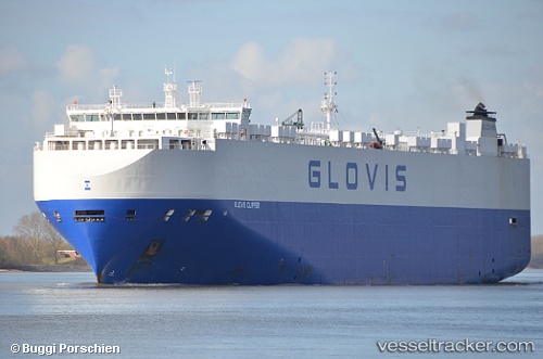
Vessel Glovis Clipper IMO: 9441582, MMSI: 311054400 Vehicles Carrier
UTC, -27.57524, 46.12003, course: 67, speed: 17.1
UTC, -27.00174, 47.81315, course: 72, speed: 18.1
2026-01-24 00:27:55 UTC, -26.77804, 48.47255, course: 69, speed: 16.9
Live AIS position:
UTC. 132 nm SE of Ehoala),
updated 2026-01-24 00:27:55 UTC.
Find the position of the vessel Glovis Clipper on the map. The latter are known coordinates and path.
marine traffic ship tracker show on live map
The current position of vessel Glovis Clipper is -26.77804 lat / 48.47255 lng. Updated: 2026-01-24 00:27:55 UTCCurrently sailing under the flag of Bahamas
Glovis Clipper built in 2012 year
Deadweight:
20434 tDetails:
Last coordinates of the vessel:
UTC, -27.99167, 44.82667, course: -1, speed: 14UTC, -27.57524, 46.12003, course: 67, speed: 17.1
UTC, -27.00174, 47.81315, course: 72, speed: 18.1
2026-01-24 00:27:55 UTC, -26.77804, 48.47255, course: 69, speed: 16.9