 vesseltracker.com
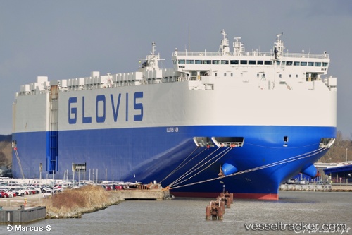
Vessel GLOVIS SUN IMO: 9749568, MMSI: 440255000 Cargo
UTC, -29.87054, 31.03485, course: 196, speed: 0
UTC, -29.87051, 31.03485, course: 196, speed: 0
2026-03-06 06:21:14 UTC, -29.94335, 31.16904, course: 172, speed: 16
Live Vessel GLOVIS SUN Analytics (details, animations, etc.)
Live AIS position: UTC. Near Island View), updated 2026-03-06 06:21:14 UTC.Find the position of the vessel GLOVIS SUN on the map. The latter are known coordinates and path.
marine traffic ship tracker show on live map
The current position of vessel GLOVIS SUN is -29.94335 lat / 31.16904 lng. Updated: 2026-03-06 06:21:14 UTCCurrently sailing under the flag of South Korea
Details:
Last coordinates of the vessel:
UTC, -29.87053, 31.03486, course: 196, speed: 0UTC, -29.87054, 31.03485, course: 196, speed: 0
UTC, -29.87051, 31.03485, course: 196, speed: 0
2026-03-06 06:21:14 UTC, -29.94335, 31.16904, course: 172, speed: 16