 vesseltracker.com
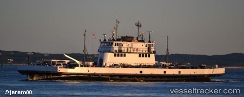
Live AIS position:
41.62978° N, 70.90584° W UTC. Near FAIRHAVEN),
updated 2025-11-19 20:05:13 UTC.
Find the position of the vessel Governor on the map. The latter are known coordinates and path.
marine traffic ship tracker show on live map
The current position of vessel Governor is 41.62978 lat / -70.90584 lng. Updated: 2025-11-19 20:05:13 UTCDetails:
Last coordinates of the vessel:
UTC, 41.62977, -70.90586, course: 175, speed: 0UTC, 41.62977, -70.90584, course: 175, speed: 0
UTC, 41.62978, -70.90581, course: 175, speed: 0
2025-11-19 20:05:13 UTC, 41.62978, -70.90584, course: 175, speed: 0