 vesseltracker.com
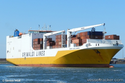
Vessel Gr. Costa Davorio IMO: 9465382, MMSI: 247311200 Vehicles Carrier
UTC, 35.15743, -75.21395, course: 8, speed: 14.1
UTC, 35.46335, -75.14863, course: 24, speed: 14.3
2026-02-06 10:00:20 UTC, 36.06049, -75.25914, course: 330, speed: 14.5
Live AIS position:
UTC. 19 nm E of Nags Head),
updated 2026-02-06 10:00:20 UTC.
Find the position of the vessel Gr. Costa Davorio on the map. The latter are known coordinates and path.
marine traffic ship tracker show on live map
The current position of vessel Gr. Costa Davorio is 36.06049 lat / -75.25914 lng. Updated: 2026-02-06 10:00:20 UTCCurrently sailing under the flag of Italy
Gr. Costa Davorio built in 2011 year
Deadweight:
24800 tDetails:
Last coordinates of the vessel:
UTC, 34.83528, -75.37708, course: 21, speed: 15.4UTC, 35.15743, -75.21395, course: 8, speed: 14.1
UTC, 35.46335, -75.14863, course: 24, speed: 14.3
2026-02-06 10:00:20 UTC, 36.06049, -75.25914, course: 330, speed: 14.5