 vesseltracker.com
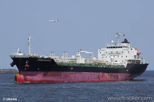
Vessel Grace Harmony IMO: 9427421, MMSI: 525100168 Chemical Oil Products Tanker
UTC, -2.35500, 117.93167, course: -1, speed: 11
UTC, -2.02667, 117.60500, course: -1, speed: 11
2026-02-06 15:43:46 UTC, -1.74667, 117.32833, course: -1, speed: 11
Live AIS position:
UTC. 42 nm S of Senipah Oil Terminal),
updated 2026-02-06 15:43:46 UTC.
Find the position of the vessel Grace Harmony on the map. The latter are known coordinates and path.
marine traffic ship tracker show on live map
The current position of vessel Grace Harmony is -1.74667 lat / 117.32833 lng. Updated: 2026-02-06 15:43:46 UTCDetails:
Last coordinates of the vessel:
UTC, -2.68667, 118.13833, course: -1, speed: 12UTC, -2.35500, 117.93167, course: -1, speed: 11
UTC, -2.02667, 117.60500, course: -1, speed: 11
2026-02-06 15:43:46 UTC, -1.74667, 117.32833, course: -1, speed: 11