 vesseltracker.com
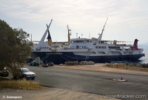
Vessel Gramvousa IMO: 7364821, MMSI: 237026200 Passenger Ro Ro Cargo Ship
UTC, 35.51647, 23.63632, course: -1, speed: 0
UTC, 35.51647, 23.63632, course: -1, speed: 0
2026-02-05 06:20:30 UTC, 35.51647, 23.63632, course: -1, speed: 0
Live AIS position:
UTC. Near KISSAMOS),
updated 2026-02-05 06:20:30 UTC.
Find the position of the vessel Gramvousa on the map. The latter are known coordinates and path.
marine traffic ship tracker show on live map
The current position of vessel Gramvousa is 35.51647 lat / 23.63632 lng. Updated: 2026-02-05 06:20:30 UTCCurrently sailing under the flag of Greece
Gramvousa built in 1981 year
Deadweight:
350 tDetails:
Last coordinates of the vessel:
UTC, 35.51645, 23.63633, course: -1, speed: 0UTC, 35.51647, 23.63632, course: -1, speed: 0
UTC, 35.51647, 23.63632, course: -1, speed: 0
2026-02-05 06:20:30 UTC, 35.51647, 23.63632, course: -1, speed: 0