 vesseltracker.com
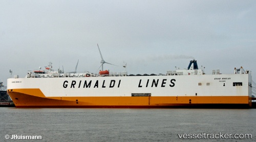
Vessel Grand Benelux IMO: 9227900, MMSI: 247039400 Vehicles Carrier
UTC, 35.93167, 27.50833, course: -1, speed: 17
UTC, 36.41252, 26.86990, course: 313, speed: 17.8
2026-02-06 18:04:45 UTC, 36.88380, 26.72090, course: 353, speed: 17.3
Live AIS position:
UTC. 11 nm SW of Myrties Kalymnou),
updated 2026-02-06 18:04:45 UTC.
Find the position of the vessel Grand Benelux on the map. The latter are known coordinates and path.
marine traffic ship tracker show on live map
The current position of vessel Grand Benelux is 36.88380 lat / 26.72090 lng. Updated: 2026-02-06 18:04:45 UTCDetails:
Last coordinates of the vessel:
UTC, 35.50476, 28.21817, course: 305, speed: 16.8UTC, 35.93167, 27.50833, course: -1, speed: 17
UTC, 36.41252, 26.86990, course: 313, speed: 17.8
2026-02-06 18:04:45 UTC, 36.88380, 26.72090, course: 353, speed: 17.3